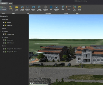
Drone2Map turns your drone into an enterprise GIS productivity tool. It lets you create orthomosaics, 3D meshes, etc. in ArcGIS from your drone-captured still imagery. You can also share drone-captured imagery products across your organization in multiple formats such as tile services, web scenes, or image services.


Comments