Transform a drone into an enterprise GIS productivity suite. Check the accessible parameters of the original devices and implement changes to enable the generation of orthomosaics, 3D meshes, and other digital materials. Organize the content in common formats.
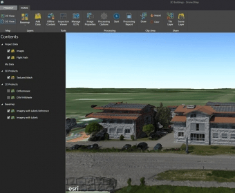
Drone2Map is a powerful GIS productivity tool that enables you to create orthomosaics, 3D meshes, and more from drone-captured still images. With Drone2Map, you can easily share your drone-captured imagery products in various formats such as tile services, web scenes, and image services across your organization.
Comments